MAKADO 2022
Instructions
17th scoring competition of pairs in mountain bike orienteering
Rogaining of 2- to 6-member teams in orienteering
Organizer |
||||||||
Webpage |
http://makado.vba.sk/2022/ |
|||||||
Date |
8. 10. 2022 (Saturday) |
|||||||
Event center |
Kamzík - Koliba, edge of Cvična lúka (48°10'56.8"N 17°05'59.0"E) |
|||||||
|
Parking and map at the Event center |
You can park in several places along the road to Kamzík.
>> open online map << |
|||||||
Presentation |
8:00 – 9:15 at the event centre. Each team will receive at the presentation:
On-site entries according to the capacity of the organizer. |
|||||||
Start |
Mass start at 10:00. After scanning the QR code START, your time will start running and you will also receive point values for the controls. It is advisable to bring a waterproof marker with you to mark points or connect controls. |
|||||||
|
Classes and Fees |
We kindly ask you to pay the entry fees in advance by bank transfer. That way we can ensure a faster and trouble-free check-in process. Thank you! |
|||||||
Map holders |
Possibility to rent at the presentation for a 2€ fee. |
|||||||
Terrain |
Little Carpathian hilly terrain and vineyards with a dense network of roads and pathways of various passability. |
|||||||
Map |
Special map for mountain bike orienteering MAKADO 2022 Map scale: 1:20 000, contour: 5m, map size: A2, state: September 2022 |
|||||||
|
Marking of the control points on the map and in the forest.
|
We recommend: - a fully charged phone - a marker or pen for the planning of the course or writing down the control numbers in case of phone failure. If the card with the QR code on the control point is stolen, please take a picture of the place. |
|||||||
|
Time measurement and passing of the Control points
|
Using QR codes. Starting, timing, confirming the passage through individual checkpoints, counting points, and ending the ride will be done through the iOrienteering application, which the participant downloads in advance to their mobile phone from Google Play or uses the link at https://iorienteering.com/. At the same time, it is necessary to have an application for reading QR codes downloaded to your mobile phone. If for various technical reasons, you can not use a smartphone with the application, just take a photo of the controls and show us the photos at the event center/presentation. If this is the case please let us know in advance of the presentation. Your time starts to run at 10.00 am. and ends with crossing the finish line. During the race, if you suspect that you did not read the QR code for the control point, we also recommend taking a photo at each control so that we can count points at the finish.
Before the start: The participant opens the application on the mobile phone, presses the orange LOAD AN EVENT button, and the application prompts him to read the QR code SETUP, which will be available at the presentation (internet/wifi/data is required for this task).
At the start: The competitor presses the green SCAN START CODE button in the application and scans the QR code START, which will be placed at the start. This will start the timer and the competitors will receive control point values, they can start the race. (internet / wifi / data is required for this task)
It is not necessary to have internet access during the race. As the coverage signal in the Little Carpathians is unpredictable, we do not recommend that because the application could skip or be reset
At each control point: The competitor must press the SCAN CHECKPOINT button in the application and read the QR code from the card, which will be at the checkpoint. The application confirms the correctness, the current time, and the control point value.
In the Finish will be the QR code FINISH, after scanning it, the application will display the total time and the sum of points. Internet/wifi is required to upload the results to the application.
For a better understanding, it is good to look at these links:
In case you are unable to use the iOrienteering app you can also take a picture of the checkpoint OR write down a letter code which is also available on each checkpoint. After finishing, please report to the organizer and your points will be calculated manually. |
|||||||
KS point evaluation |
Each control is evaluated with a point value in the range from 0 to 100. Competitors will receive the values of individual checks at the start. We would like to warn the competitors that the controls with a score of 0 are not placed in the field at all! |
|||||||
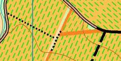
The special map marks |
It is strictly forbidden to ride or walk off the road in the vineyards! Exceptions are grassy strips marked with orange (map mark No. 839 “Driving area”), where movement is allowed.
There are forbidden areas, which are marked on the map. It is not allowed to cross them (by bike or on foot). This also applies to roads leading through these forbidden areas.
|
|||||||
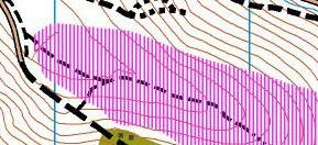
Forbidden area |
Is marked on the map
|
|||||||
Finish |
The whole team comes to the finish together with minimal margins. Time stops after the "Finish" finish line is reached and the FINISH QR code is read. After loading your race, the total time and the sum of points are displayed. In the event center, the competitors upload the results to the applications. In case you were not using the iOrienteering app but you took a picture of the checkpoint OR wrote down a letter code which was also available at each checkpoint, after finishing, please report to the organizer, and your points will be calculated manually. |
|||||||
Time limit |
5 hours; Finish closes at 15:30. |
|||||||
Rating |
Points for “stamped” KS are counted. Penalty for exceeding the time limit:
In case of equality of points, a better time decides.
|
|||||||
Rules |
According to Rules Pravidiel OC SZOŠ (clause 10.9.)
an earshot distance
|
|||||||
Prize-giving ceremony |
Will be held after the race – on Saturday at app. 16:00. |
|||||||
Catering |
Aone regeneration drink at the finish. In the center of the race there are 3 buffets where you can buy refreshments After the race, we will prepare a traditional barbecue, to which we invite all competitors. Please bring your own cups. |
|||||||
WC |
In the new building of Mestské lesy next to the road opposite the competition c center. |
|||||||
Dressing room |
Two tents on the Cvična lúka in the event center. |
|||||||
First aid |
There will be medical service with an ambulance in the event center. |
|||||||
Warning |
|
|||||||
|
Mandatory equipment
|
|
|||||||
|
Recommended equipment
|
|
|||||||
Officials |
Event director: Katarína Müller Papugová (tel: +421 907 646 551) Course planner: Stanislava Ančicová Main referee: Barbora Šmelíková Map and graphics: Miroslav Lago Secretary: Eva Králová |

Warnings: Competitors accept the hazards associated with participating in the event, and that they take part at their own risk, are responsible for their own safety, and have no claim against the Organizer in case of injury during the event, or caused by it later on. Marketing and sales activities in the event center only with the permission of the director. By taking part in the event, every participant consents to storing his personal data (name, class, club) in the information system of the Slovak Orienteering Association and publishing them on the event websites (in entry and start lists and in the results). Unless you ask the photographer for a specific exclusion, by taking part in the Event, you consent to be photographed, waive any and all rights of publicity or privacy and grant the Organiser permission to utilize your image in documentation and marketing materials.